


“Tap your right temple” he said.
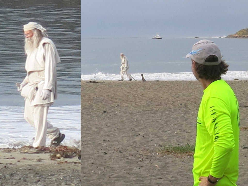
Exactly what this guy was sharing would take me the whole 7 hours of paddling to digest. I mean, its not every day when you are rigging your canoe to launch for the final day of a 120 mile adventure, that someone walks up the beach that looks initially like a storm trooper, then perhaps a bee keeper. Then once you notice his staff and beard Gandolf the wizard. And finally, with his white gloves and outfit, Obi-Wan Kenobie.
“This is the part of the brain that contains your memories. And if you recognize that, and take a step back, you can see the future.”
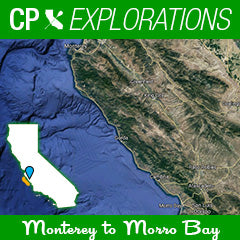
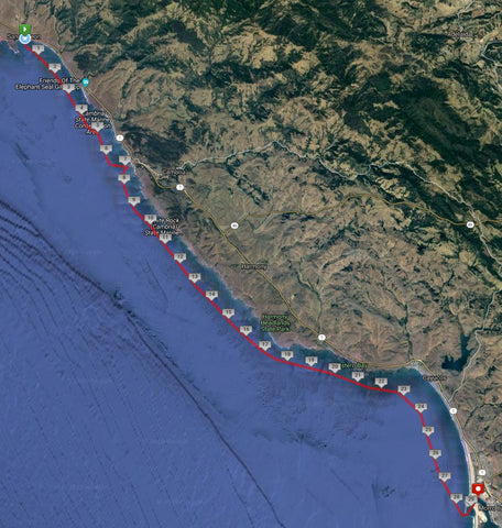
His name was Wes. And if there was a part of this adventure that really gave me pause, he was it. But let me start from the beginning…over 90 miles to the north, where I began this paddle journey. In Carmel, Monterey County.
This adventure and trip could not have taken place without a village. From equipment to logistical support. Phone calls to pick the brains of locals, to days spent at the top of cliffs with binoculars to make srue I was still dry side up. Thank you paddle community! ~Clarke
Day 1 - Montastery Beach to Andrew Molera
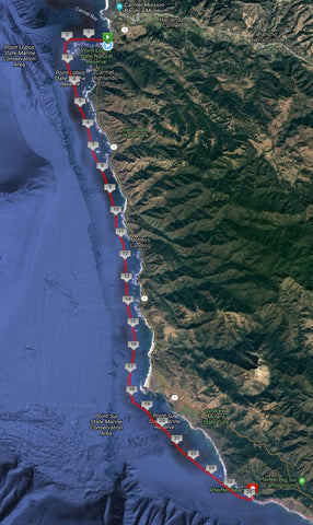
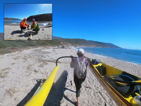
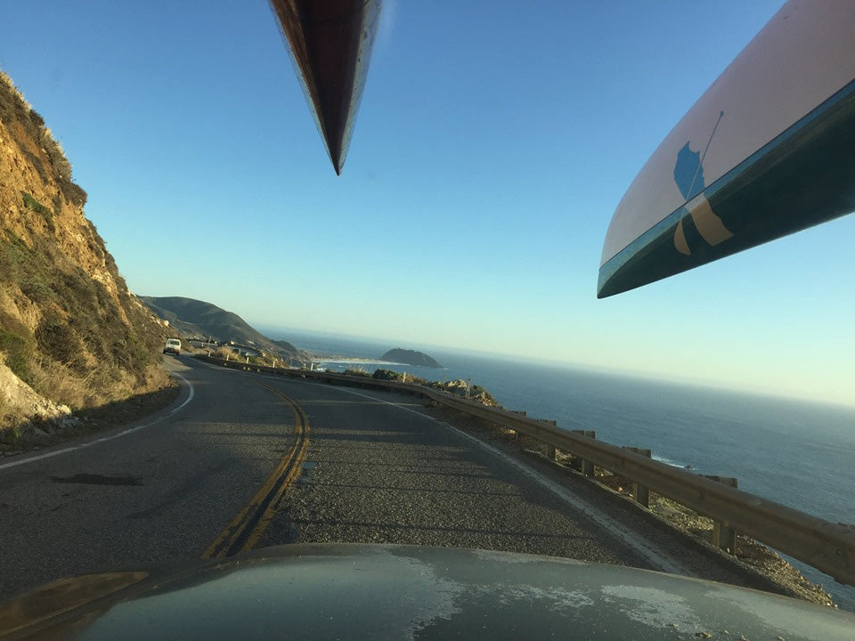
Monday morning. Day 1. Montastery Beach Carmel California. The push-off from this cove beach alongside highway 1, with knee high shore break was as easy as I could have hoped. The morning's glassy conditions and calmness were welcome considering I was nervously excited to see 4 weeks of planning, and years of wondering begin. My wing-man for this trip, Siam Mendoza was helping check my rigging, and doing some video of the morning. I was doing equipment checks on everything that would be strapped to me and my canoe. And I was listening intently to a paddler name Robbie who was kind enough to come down and send me off after hearing about my trip. We talked about winds, currents, sketchy spots, and how much fun I would have. A little further down the beach, my companion on this first day, Priscilla, was getting her oc1 rigged and checking with her land crew Jody. A few minutes later, it was time for some photos, and some last minute debrief of rally points, expectations of what the land crew would be doing as we paddled, and making sure we had a good understanding of what the landscape would be to match the mile by mile itineraries and maps I had laminated for each team.
We pushed off to the west, did a quick radio check, and rounded the corner into the southern abyss. The Big Sur coastline!
So for those that don’t know this stretch, it is one of the most scenic routes to travel in California. Cliffs hundreds of feet high, windy roads, waterfalls, redwoods. Driving the stretch is slow going, even if you don’t pull out to take pictures and soak up the amazing views every five minutes. But so much of the view is hidden from the population because there is so little access to the water. Private property, vertical drops, sea mounts and hammering surf have made the guard rail along highway our one and only way take in the view. Unless you are willing to paddle it. Which is what I had set out to do. Now mind you I am not the first. In fact I can probably count ten people I know who have kayaked, SUP’d, OC'd or surf-ski'd along parts or all of this coastline. So I do not pretend to be a pioneer or some crazy achiever. I am simply just really fortunate to have an opportunity to fulfill a dream and am seizing it.
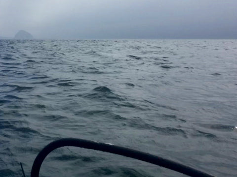
The first morning would quickly go from calm and mellow to high alert, as the visibility deteriorated by mile 3. The fog we thought would burn off went from .5 mile visibility to 50 yards. Priscilla and I were working hard to use our available senses of sound and feel to compensate for the bad view. We decided to paddle outside of the kelp line to make sure we didn’t crash and burn on inside waves, and the hundreds of rock formations that dot the coast. The ground swell was fortunately running in our direction which helped guide our path south. Using our ears to listen for crashing waves to our left, and in front of us helped. And the kelp we encountered was pointed in the direction we needed to go as well. Many clues were available for the next 10 miles. We just had to be alert.
Unfortunately, our land crew was encountering the same challenge. Pullout spots we had designated for visual checks were too socked in to even see down to the water. The thick fog even hampered the ability for our marine radios to get clean lines of sight and allow for radio communications. It was not until mile 12 that our two groups were able to finally get radio contact. But no visual still. So we paddled on. Conditions appeared to be lifting, and like I said, we were headed the right way.
We had stopped where my GPS SatComm device told us awhile back was the famous Bixby Bridge. But sadly we couldn’t see it from below as I had hoped due to the fog. So we kept on. Around mile 17 the fog lifted. Blue sky started to appear, and our moods lightened. Able to see our surroundings, and the sneaky outside rocks we were skirting inside and out of, we started to enjoy the rollers that were heading our direction to surf. Rocks, cliffs, and green covered mountains covered the landscape. Birds circled way up above. Giant prehistoric looking bull kelp decorated the ocean. It was beautiful just like I had always dreamed. But despite the lightening of our situation, we still had one major thing to conquer the first day. Point Sur.
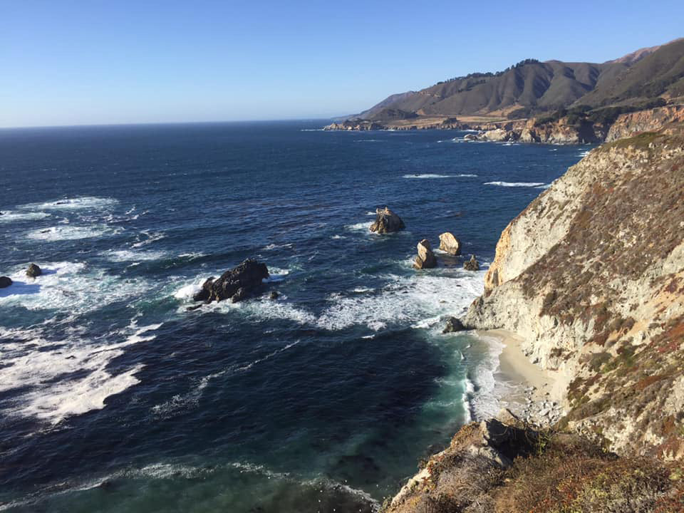
Point Sur, as with all coastal points that jut out into the ocean, is a confluence of various currents. Where energy of wind, water and tide do various dances that make even the most predictable weather patterns run for cover. Rounding this point had been a pretty big landmark for us on this day’s journey simply because conditions can get sketchy there. Not to mention it is the bottom section of what is called the Red Triangle. One of the world’s most common great white shark hunting grounds. Not that we would suddenly be in the clear once we got past it in regards to the risk of shark encounters, but we knew that we would be right in the thick of it until we passed it. Fortunately, the conditions and the local teeth-laden residents in the gray suit were pretty chill. And once we rounded the point, we were on our way to our landing options at mile 23 and 28, Andrew Molera and Pfeiffer Beach respectively.
The point proved to be pretty tame. Some breaking waves on big underwater sea mounts to navigate around. And certainly some strong currents, but for all of the anticipation of what this stretch might be, we were spared. In fact, outside of the earlier fog, our biggest obstacle now would be the kelp. Navigating in and our of the thick forests often made our progress come to a stop. We ended up going inside of the seaweed forests now that we had such solid visual of the land, and we came upon our first possible landing spot, Andrew Molera. I had wanted to push on for the day further to Pfeiffer Beach, but we had not gotten radio confirmation yet from our land crew that they had scoped it out and declared it a green light for safe entry. But looking at Andrew Molera, and seeing a well-timed point break that made me want to surf my oc1 for hours there, and the quick sprint to a protected cove made us realize an entry like this would be hard to find anywhere else. Despite knowing that the google maps would have us having to carry our gear and boats for a long hike to the parking lot.
So, we beached the canoes, celebrated our first day, and shortly after, got radio contact with the land crew letting them know of our location. After so much hit and miss with communications, it was welcomed by both groups to have locations, and be meeting soon. Which, after 5 minutes on the beach enjoying a gorgeous view of waves, a river, the coastline and even some surfers, we saw Si and Jody walking to the beach to our location. Hugs and celebration of our success ensued.
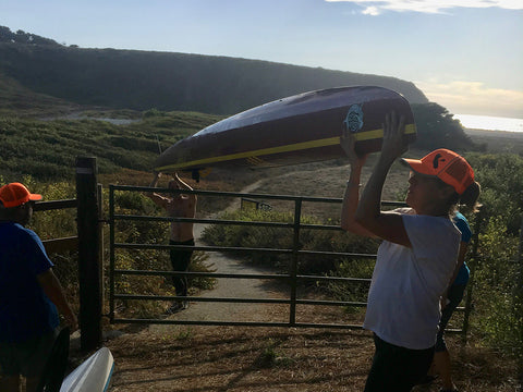
Our good mood was quickly tempered though when they told us the van had broken down. Parked at a pullout on highway 1 by the Bixby Bridge after stalling out repeatedly. Si, who knows how to drive a stick and talk sweetly to my 87 VW Westfalia van named Eddie was at a loss. Right away my trip was at risk. Would this be a one day adventure? Would Eddie be towed to Monterey and locked in a lot for several days when I should be paddling? How would we even get a tow truck with cell service non-existent around here? I tried not to panic, but inside my stomach was twisting in knots on how we could salvage even just a part of this trip. We spent the next hour hiking our canoes back to the lot and figuring out how to get all our gear, 4 people, and two canoed tetris’ed into Priscilla’s tiny but reliable truck. She was a zen master at this time, calculating every inch of usable space, while Jody, Si and I just tried to stay out of the way. My energy was spent trying to figure out various game plans, step-by-step. Intermixed with apologies to everyone for screwing things up with my old unreliable van. I had taken it to the mechanic twice the week prior for tune-up, oil change, thorough once-over and was assured it was good to go. But in the time since I left, the odometer had stopped working, (sort of important since my notes to Si were all mile by mile breakdowns), the gas meter wasn’t being accurate, and now it was not working to even drive. So yea…first step, get to the van with all of us crammed in the truck, and see if maybe I can coax it to work. If not, get a tow truck and see what we can salvage.
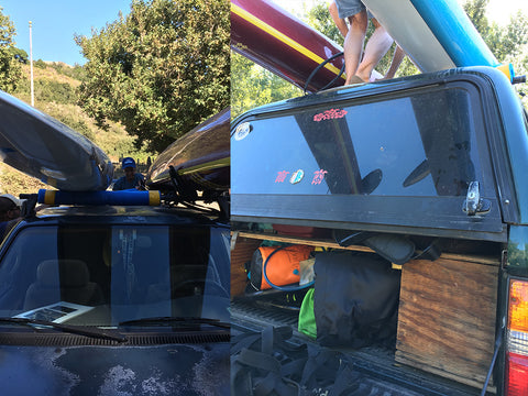
The great news, was after driving the 20 minutes to the van, it was still there (I admit now I had fears of it having had rolled off the cliff it was parked at). Loaded up still with Cali Paddler gear, and waving to me with its silly side mirrors, as if to say, “Hi Clarke, how was your paddle?” I checked the oil, I checked the coolant, and didn’t see any leaks. I started it up, and voila! It purred. Si was shocked. I was relieved. Priscilla and Jody were confounded. The land-crew repeatedly said, "it didn’t sound like that last time". So we celebrated this good fortune, but knew at any moment we could have it break down again. We decided we would head back in the direction of town, pickup Jody’s car in town to have an extra vehicle, and if Eddie broke down we would at least be closer to a cell signal and tow service.
Fortunately, our luck would continue. Eddie purred and drove perfectly, we got the extra vehicle, and headed to Pfeiffer State Park for our first night of camping. Delicious chili, camping alongside a creek, deer and a clear sky set the stage for day two, where we would paddle from Pfeiffer Beach to Limekiln or Sand Dollar Beach depending on conditions, 28-33 miles.
Day 2 - Pfeiffer Beach to Limekiln

The next day was nothing like the first in terms of visibility. Fog was never a factor as the sun greeted us before the alarms went off. After a hearty breakfast of eggs and bacon prepared by the awesome Jody, we loaded up and were off to find Pfeiffer Beach, the launch site hopefully for day two. Priscilla would be joining me again before she and Jody would head back to their normal lives. Finding this beach however would prove very very challenging. We overshot the Sycamore Rd turnoff right away, despite knowing it should have been within a couple miles from the campsite. Not seeing a big sign or arrow to the beach, we kept driving. Finally after much too long, we realized that our map and visual cues were telling us to turn back. We retraced our steps, and overshot it again. But this time I saw a turnoff that looked sort of where I thought we should turn. Just not signs. Not wanting to lead our caravan down a gnarly private road, we stopped and asked a ranger at a nearby camp, they assured us that the road we had just passed (again) was the mystery road, and that the yellow sign indicating hazardous turn would be our only visual marker. The two vehicles headed south once more, and pulled down the road. After 100 yards, we finally saw signs. None of which viewable from the main road.
We were running later than I wanted. Originally 9am was my hopeful launch time. but by the time we parked and walked to the beach to scope out the launch scene, it was 10am. The launch would not happen too soon though because when we walked up, we saw some mackers of waves coming through which could easily crush a canoe. For the next hour, we timed sets. Scoped out various spots that would be best to try to get through at. We agreed to go get the boats loaded and rigged and carried to the beach, but that if we didn’t feel it was safe, we would just carry back to the cars and head to Andrew Molera again. By the time we got to the water, rigged and ready, Priscilla and I had chosen the best of several challenging options to try and launch at. Steep shore drop off, with the sets breaking 150 feet off the beach, and various rocks and hazards and currents to content with, our launch would have to be tactical, swift, well timed and lucky. It would have to be perfect. At one point Priscilla said, “this is your trip, I don’t have anything to prove.” And to be honest she was right. I was not about to risk her getting hurt or damaging her canoe to punch through some seriously angry surf. And the idea of two paddlers BOTH getting lucky enough to make it out seemed a long-shot at best. Not to mention our landing spots were complete unknowns that day, and we might find ourselves in very dangerous situations to just get in safe. At this time, I made the call to have her hold off for the day, despite knowing she is as skilled as me, and said I would line up at the water's edge and give it a look and just see if something appeared. With Si on the back of the canoe, if we would saw a window open up for me, I would go for it. If not, then I too would pull the plug and we’d find another path to paddle. If I did make it out, I would paddle halfway down to McWay falls at mile 14 and wait for radio contact that had scoped out the landing spots to see if they were safe. Green light, I would keep paddling to Limekiln or Sand Dollar. Red light, I would back track to here, or even back up to Andrew Molera if needed. But first, I was standing waist deep, timing sets, and waiting for that perfect window to try and deny nature its paddler meal served with a side of cleanup set wave.
As I should have mentioned by now, I trust Si. A lot. He surfs and understands waves, and their nature. He paddles and understands how canoes can get obliterated in some situations, and survive in others. And he is a thoughtful person who cares about my well-being. All things that led to my asking him to be my land-support. And on this day, with both of us watching set waves indicting off a point way outside, we were lifting the canoe up and over countless whitewater waves until we both saw the window. And it may have been the most perfect window we would get. He said “now” at the exact time I said “this is it”. Knowing we both felt right about it added to my confidence as I hopped onto the canoe, he pushed hard, and I paddled for my life. 20 feet in, I crested one wave about to break, and then took a left angle to avoid a wave breaking further out coming from my right. I just barely cleared that one, and as Si later said, “the back half of my canoe was completely out of the water” as I just crested the breaking way. 2 feet further in and I would have been toast. I kept paddling like I was being chased by a swarm of bees. Well beyond the breakers, just in case nature thought I was getting complacent. I had made it! And the sound of thundering waves almost made me miss Si’s call on the radio for a comm check. He also said that Priscilla, seeing me make it out there was having second thoughts to try and make it too. I quickly called off that however. I was lucky, not good. And for her to get the same luck, was a long-shot. Two much risk for both of us if something happened on her attempt, such as me having to try and land back here to help. And if she got hurt, my land crew might be unable to spot me for my needs. I know she understood, but am sure it was hard to watch me paddle away down the horizon. Her schedule would get reworked though, and she’d find a way to keep me company on day 3. But for now, I was solo, and would be for the next 8 hours.
I got the canoe moving pretty quick. Had a slight headwind but my stoke at this point to see the coastline was offsetting the breeze. By mile 3 I was running a solid 6mph with my loaded boat. I would stop every hour or at 5 mile marks for breaks, as is my standard routine on these sorts of paddles. I eat, drink, stretch, dip my legs in the water to ease my lower back. Lube up with anti-chaffing cream, and apply sunscreen. I would also use this 5 minute break every hour to radio to my land crew, now three strong. Si would be darting up ahead to the possible landing spots, to then be back at the 15 mile spot, McWay Falls to give me the prognosis. Would this be an epic point to point paddle day, or would it be a 30+ mile long out and back.
Along the way, with no roads, buildings or people in site for the last 30 minutes, I came across something I had feared. Not a shark or crazy hazard. No, worse, man’s impact. I saw it floating in front of me a ways, hoping it was a bird on seaweed, a sunfish, or big jelly fish. But sadly, it was a mylar balloon. There wasn’t a beach or town within 40 miles of me, and yet here it was, trash from a person, floating in nature’s most pristine and undeveloped coastline south of San Fransisco. It read “happy birthday”. But really it should have read, “ban mylar balloons”. I packed it up with my gear, and headed south. Hoping to not encounter more.
I was about 1.4 miles off short when my gps watch indicated I was near the spot. McWay Falls was one of my highlights for this trip. It is one of the most famous waterfalls in the state. Photographers lines the cliffs above to capture a waterfall descending right onto the beach 40 feet below, right into the awaiting ocean. Some tourists consider this the scenery highlight for the whole Big Sur coastline. Despite its popularity though, there is no access to the perfect cove and waterfall receiving beach below. Rescues are made each year as tourist try to find the elusive and non-existent trails to get close to the prize. And hefty fines are doled out to anyone who tries to create a path, and requires emergency cliff rescues when they get stuck. So for me, paddling up and seeing this waterfall was an opportunity I would be very excited to do. I would not land on the beach, or paddle in too close. I understood that there would be plenty of eyes on me from above and didn’t want to set a bad example, or tempt others to try to find ways to paddle outside of their capabilities to reach this magical beach. So I just stayed outside the cove, took some pictures, and soaked in the specialness of how I was one of perhaps a dozen people to ever see the waterfall from …. the water.
After getting radio contact from Priscilla and Jody, and asking them to take pictures of me, Si came on to the radio as well. He brought wonderful news that “Limekiln landing was a green light”. I would get to continue my journey south. Trusting his watchful eye for my fate, and having discussed at length what I needed him to look for in landing spot evaluations, I knew he would take into account my safety, but also my comfort in surf conditions. He knew I wanted to make this journey happen, and it was up to him to line up the exact channels, time the sets, and make me aware before coming in of any hazards.
So I headed south again, stoked beyond measure to be flying down beautiful coastline, towards one of my chosen landing spots.
Limekiln is a small little rock quarry canyon with campsites in it. Tiny but pretty. But so tiny I almost missed it. I turned the corner at Lopez Point and saw some tents or buildings way off in the distance. I headed for that cluster, thinking it was my marker, and too lazy to check my gps. Well fortunately, in 40 minutes or so, I got a radio call from the team asking me my location. I checked my location and way-point and realized that the buildings I was aiming for were 3 miles south of my spot. In fact, I needed to turn inland asap as I was directly off of my landing zone! Pretty cool when you are 26 miles in and shocked to be done. Versus the usual, wishing you were done but still having an hour to paddle. So, I did a quick course correction, checked with Si about the terrain and beach hazards (minimal, just 2’ shore-break with lots of time between the waves to time it) and was in view in 5 minutes of 'Team Orange Hats', our matching neon high-visibility hat color of choice. Floating on the momentum and confidence of an amazing and fast day on the water, I strode in through the surf like a knight on a horse, and turned around to see the sun setting on the horizon. A great day indeed.
Day 3 - Limekiln to San Simeon (or what ended up being San Carpoforo)

Day 2 had been an exhilarating, technical and lucky launch. So pushing off at Limekiln the next morning was pretty chill. A quick jump over a shorebreak wave and off I went. Priscilla had missed the prior day due to the surf, and was disappointed, so she rearranged her schedule to join me for what was supposed to be the longest day of the trip, 37 miles. Only it turned out a little differently than we expected. Ahhh plan B and plan C. I always try to have them, but have never had to really use them.
The day was pretty mellow. We had a little tailwind around mile 6 as I stared up at gorgeous mountains for the last day. The terrain would be changing around mile 15 as the unofficial start of the Big Sur coastline starts and ends at Ragged Point. The giant mountains covered in forests with huge cliffs give way to golden rolling hills as we head south. I made a point to soak in each big peak and wind funneling canyon as I passed them along the first half, knowing that there are few places in our state so grand and giant and raw. But a new scenery would take shape, and I was eager to see how 5 miles could so drastically change in terms of terrain. A mile after my first second break at mile 10, (which included a nice huli while I was SITTING on my canoe stretching and eating some lunch!), the conditions started to get a little less friendly. I had checked the marine forecast the night before using my SatComm device which can pull down those readings. There was to be 10-12 knot winds but onshore (right to left). But what we ended up getting was far from that. And even farther from that direction.
Way off in the distance was Point Piedras Blancas. A Giant jutting mound of land with a lighthouse on it, and a sure thing for some mixed up wind and water. But we were far from it still when the wind started into being a headwind. And not just 10-12 knot. I would say it was sustained 15 knots with some gusts of 18+. And certainly not from right to left. Our speed halved within two miles. We continued our best to crawl along. A radio check with Si suggested maybe cutting in to get some protection from the wind in the lee of the cliffs, but doing so too much would mean having the wind ama side when we had to turn back west to get around the point. And beyond the point was 7 more miles to our finish. The wind was causing our speeds to get in the 3-4mpg range and I started doing some math. We had 15 miles to go to get to our 37 mile mark finish. It was 2:30pm. That means if conditions and speeds were the same, we’d not pull in to home until 6:30-7:30pm. And that wasn’t even accounting for possible fatigue, crazy conditions at or beyond the point, or any other unexpected happenings.
I checked with Priscilla, her comfort in these sorts of conditions, and mine, were ok based on our past history of paddling in rough headwind conditions. But she looked up ahead and saw very few landing spots in the stretch to the point should we have to pull the plug, and just inside of us was a pretty inviting spot. I could have pushed on, heck, I did the Davenport race this year into a 25knott headwind when it was 'supposed' to be a great down-winder. But every so often, I think about “can” and “should.” Was I disappointed to have to abandon this day's preferred destination for backup plan spots? Yes. I was VERY disappointed. I may not ever have this chance again and it was getting blown away, but considering how many things had been going right for me, I didn’t want to get greedy. The fact we were within a mile of safe landing spots made it almost seem perfect too. That said, we spent the next hour on the radio trying to have Si and Jody get our location. The wind and drift of our canoes made it very challenging. Plus the lack of landmarks. The spot we were directly off of was Arroyo Hondo. A spot I had earmarked. But I needed Si to verify road access to that once we beached we would actually get up the cliff to the cars. And with so much poison oak, cliffs, barbed wire and who knows what else between the water and much of the road, I didn’t want to risk a beach entry only to be marooned on the beach. The land team was unable to find a way down to where we would land, despite what looked like a softish landing, so after 30 minutes of radio back and forth, and me wrapping around my leg strands of kelp and sea weed to anchor me from drifting, it was determined we would have to try for plan c.
So for the next ten minutes we got to paddle WITH the wind slightly as we headed back north to San Carpoforo River. This giant crescent sand and rock beach was not as chill as the previous one, but Si and Jody walked a half mile down to the water along a trail and were in visual range for us to see when we pulled up to the beach to assess together. At first, they suggested the middle of the beach. But Priscilla and I saw some thunder waves go through that made us want to explore other options. We asked Si to walk all the way to the South end, which looked very protected for a beach landing. But apparently you can’t walk to the spot we had hoped to come in at as there was a giant cliff blocking beach goer access unless a neck high swim in surf was wanted. So we had to nix that appetizing option. We came back to the middle, and then Si went to the north end where I saw a little better option in terms of time between sets. If we could just time it right we’d maybe get in (mostly) unscathed. But man, the sets were breaking far out, and probably 4-6 foot. At this point, Si and I determined the North end was going to be our go spot. I told Priscilla earlier that Si would be who we trust if this was a make-able beach or not. He can see things much better than we can. Steepness of the waves, their size, their reforming, and what they crash on. And he said it was make-able, so we would be going on that.
I gave Priscilla a couple minutes to wander out past the set line then asked if she was ready to receive some full on stroke-by-stoke instructions from me to get in at what was "our best option". She replied, “you mean best of the worst?” I took that to mean yes she was ready, and gave her instructions from there on out. “come in a bit”. “Stop there”. “Wait.” “Wait, back pedal”. “Goooooo, ok now stop.” Then as we had creeped just to the edge of the surf line, I saw her window and told her to “GOOOOOOOOOOOOOOOOOO. Go hard go now don’t let up!” She responded to everything like a trained surgical assistant with “scalpel” and “suction” requests. And she paddled really hard before getting lifted up and pushed to shore by a wave (small for this day but not something we’d seek out any other.) I saw her window and realized that by coaching her in beside her, that I was too far in to try and back out in case a set decided to build and break. So on a wave shortly after her, I started to hammer in as well. I saw her in front of me catching a wave, then huli. I was surfing a wave at this point, but it was headed in her direction. With the slightest angle, my canoe caught some rudder and I spun sideways, ama first and I then proceeded to side surf the wave (actually it surfed me I was just along for the ride at this point) for a few seconds. At this point I was thinking I might have a glorious and rock-star entry to land. Then, just as quick as a clap of lightening, my ama went down, I felt my canoe lift as the wave lifted it up, and I fell/jumped off, as the canoe huli’d ama side.
What felt like minutes was probably done in seconds, but I touched sand with my feet pretty quick and flipped/spun my canoe to point in the right direction, saw that Si was helping Priscilla get onto the beach, and sprinted my canoe up to the beach where Jody was able to lift the front before additional waves could crush me. Jody yelling the whole time, “hurry here comes another” which made me chuckle as I knew the ocean would keep sending them regardless, because that is what it does.
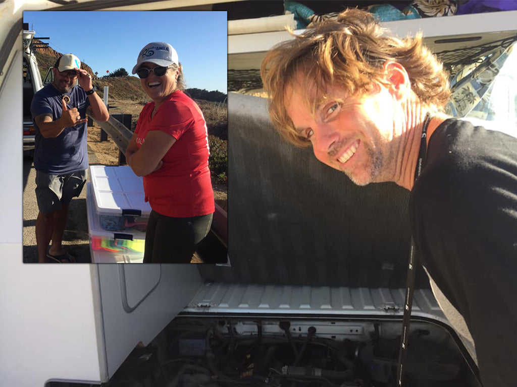
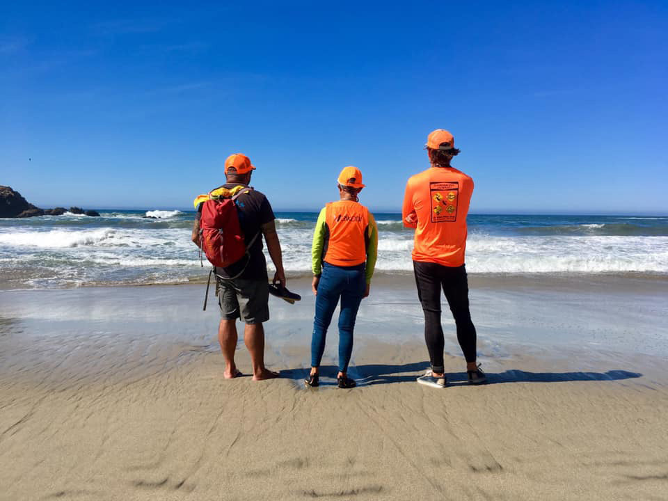
Once on the beach, we exchanged hugs, and did gear/body checks. I tried to get my wet clothes off to warm up only to start shivering uncontrollably. That water was cold, and I had spent a lot of adrenaline and calories trying to conceive of a way to get us in safely. I was toast. Cold toast. Another hour of hiking canoes up to the highway, and we were strapping canoes to the roofs and greeting a new set of our friends who met us there, Gary Canon and Di Rose. I posted a Cali Paddler sticker on the guard rail which was enriched with about a hundred of local surf stickers, and deemed it a good 25 mile day. Well short of where I wanted to have landed, but we were in safe, and I would live to paddle another day. Which would be the following morning, and turn out to be my favorite day of the journey.

Day 4 - San Simeon to Morro Bay
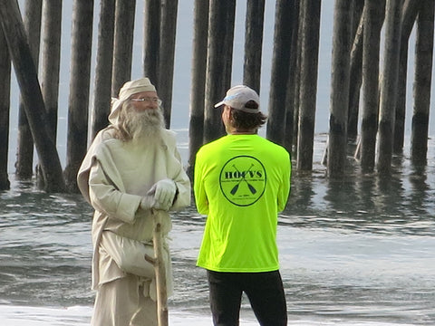
You might recall at the beginning of this long story, I introduced Wes. The long-bearded older gentlemen who grabbed my attention walking down the beach looking like Moses. Well, this trip had been lacking a little something for me. Sure I had seen sea life, amazing scenery, faced adversity, spectacularly enjoyed my time and such, but often times on these long journeys I am seeking something deeper. A connection to embrace the ocean, my life, my ancestors, and to hopefully walk away with a renewed sense of purpose. I don’t necessarily go searching for it, but I am always actively open to it, ready to receive the signs only the ocean can give me that I am grateful, alive and part of greater purpose. Seeing and meeting Wes that morning made me think this would be a special day.
“Tap your right Temple” he repeated per my request to clarify. “This is where your memories are stored and to see the future.”
Well if that wasn’t a contradiction, I didn’t know what was. Good thing I had some time to reflect on the lessons he chose to share with me on the beach that morning. After explaining in a cryptic way what he meant, juxtaposed with other interesting stores of the San Simeon cove we were standing at, "filled with orcas one year, birds the next, fish at some times of the year. And others, simply empty and calm." He took it upon himself to bless my boat and journey. “From the east, west to north and south. Bow, stern. Your port and starboard” pointing to my canoe points and the sky. I don’t have any idea what credentials to bless me he could boast, but I accepted them as if the pope himself had taken a moment to give me well wishes.
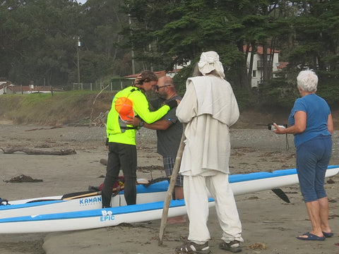
So, shortly after, embracing last minute encouragement from my friends Di, Gary and Si, I parted ways with the land, crested a shorebreak wave, and started my paddle ‘home’ to Morro Bay, 28 miles away. The coastline around here was pretty in a different way. River-mouths and rocks. Barking elephant seals on the beach, challenging each other to 2000lb battles for dominance on land, and gliding under the water curiously wondering if I was trying to steal their mate or fish. I strayed further offshore following the first one I saw. Plus there was lots of seaweed to avoid on the inside. The town of San Simeon and Cambria waved to me. These would be the last cities I see for awhile. My map and itinerary had a very very long stretch of no contact this day. 15 miles of no radio/visual contact, no public roads, or reachable access. After mile 9, I would pass Moonstone Beach, (a great river-mouth surf spot, but also very sharky), and be on my own for 2-3 hours. I was really excited for this last challenge. Loneliness and remoteness is a challenge and burden, but also a gift. It forces you to be alert and thoughtful. Tuned in, but also tune out. The Harmony Headlands stretch as I called it would provide this. Gorgeous rolling hills, no development, no hotels. No roads really except for two private farms/homes that had dirt roads leading down canyons to them.
The seaweed here was more challenging than at any time this week. I was letting swells lift my canoe and timing those moments to cruise over kelp paddies which would sink underwater for a short respite. The conditions were benign, for the most part. It was me and my loaded canoe on neutral water, just cruising. Meandering in and out of kelp gardens, grateful I had on a swept back rudder so it never got caught. Each time I passed a new kelp patty, sea otters would stare at me. Debating if I was too close for comfort and jump in the water, or simply watch me curiously. I did my very best to spot them early so as not to disturb them (trying to be Sea Otter Savvy) and change my direction to avoid getting too close. Sometimes it was birds who would be baffled at the sight of me. Sitting on a raft of brown kelp, turning their heads in unison as I slowly cruised by. On one occasion there was a bird sitting on a floating dead bird. That gave me great pause. My thoughts grew introspective. I took a break in a few minutes, and during which, tapped my right temple.
Part of my routine with long paddles, especially when I am out there by myself for 6-8 hours, is to reflect. I have conversations out loud with myself. I talk to people who have passed away and been instrumental in my life. I point out pretty things I am paddling by out loud, which causes me to pay more attention to the beauty I am seeing. And there was plenty of this here. Sea life. Untouched hillsides. The sounds of birds and waves replacing the normal soundtrack of cars and voices.
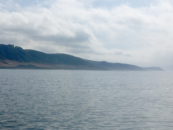
I was coming up at a big point on the horizon, and the visibility in front of me revealed land waaaay up ahead. I wondered if it was something I would be aiming for to be my finish, but then as I continued to creep towards the point, a giant rock mountain appeared in the haze and clouds. I knew right away, my checkered flag was in sight. Morro Rock.
At 581 ft high, this volcanic mountain is as iconic of the central coast as anything else. It also marked the entryway to Morro Boy, where I would leave the ocean and turn east to finish my paddle at Coleman Park in the protected harbor. Once I rounded the Harmony Headlands point and came upon Estero Bay, civilization reappeared. My wingman and I were able to finally connect on radio and with a visual at the preplanned spot north of the town of Cayucas in Estero Bay. I saw the White VW van pull into a parking lot and knew my loneliness would be gone now. I felt relieved and sad at the same time. Knowing that I was on the home stretch now for my journey.
Rather than follow the coast, and make the day be 31 miles, I notified Si that I would be taking a tangent route across the giant indentation of coastline directly to Morro Rock. While I loved the idea of seeing more coastline up close, I was ready to avoid seaweed, open up my engines a bit and hammer the last 6 miles...and not tack on more than I had to. Of course taking this tangent would send me really far off the coast. About 4 miles offshore at the furthest point. So I guess the remoteness of my journey was still present after all, even as I found myself so close to the finish. This time, I was just further 'out'.
The conditions and wind started howling a bit but the direction was onshore, so it was hitting me on the right, instead of the gnarly headwind from the day before. I had picked the brain of many locals including Patrick Lyons the week before and was told the wind here can lead to some epic downwind conditions. It was not lining up perfectly for that today, but it was quartering just enough that I could tack left and right every so often to get a great ride.
So, Wes came into my mind again around here. What did the past mean about the future? I started thinking about the past of this trip, how I had seen so many cool elements of nature. But sadly, I hadn’t come across the biggest and most impressive animal of all. Despite being in whale country and told sightings along this coast were commonplace.
I have been very fortunate to have special experiences with whales in my life. Encounters that have really changed me. A baby grey whale in Santa Barbara curiously swimming under me for several minutes while its parents were 100 yards away. Or having three whales escorting me shortly after a lei from my dad’s funeral fell into the ocean (Santa Barbara to Malibu). In Hawaii, there is a concept of our ancestors who pass, taking on the form of other animals and keeping a watchful eye on us. These are our amakua. While I would not be so bold as to self-assign what form my amakua might take, my encounters with whales have been so special in my paddling life that I have always wondered if there might be a special connection.
So, after almost four full days of paddling, and exploring and putting myself in the heart of nature, I was a little sad I had not had some special whale sighting. Some chance encounter to put me on that paddling level of gratitude where the canoe moves with emotion more than strength. But nothing up to now. That said, I was grateful for the otters, the dolphin at McWay falls that playfully splashed me, the seal that kept following me on day two, and even the amazing birds who kept my soundtrack from ever being boring. And hey, not seeing a shark was pretty great too.
So, my thoughts shifted to whales a bit, and how I was lucky to have had the encounters I have had. I remembered them in great detail. Where I was in life when they happened. And my longing for an encounter shifted to gratitude for the memories I had already made. I had already experienced that special animal. Why feel sadness that it didn’t happen here. In fact I scolded myself for any sense of entitlement harbored. I picked up my pace now, really throttling my stroke. Letting my tired body give way to an uplifted spirit of gratitude. My memories on this trip, and in the past were plentiful, and there are few people who have been as lucky as me to see what I have just enjoyed. My speed for the next mile was a 8:45 mile. Not bad I thought for mile 26. I skated towards the rock. Knowing the real world awaited me on the other side of it, and that my readiness for it was real. I had one more mile to go still, and was about to see the backside of Morro Rock, which only those who paddle or ride a boat can witness. Such great memories. Little did I know where they would lead my future. But I was starting to interpret my lesson on the beach that morning with more clarity.

I had friends who had mentioned wanting to greet me at the entrance of the harbor and escort me in on their oc1s and oc2s. I didn’t want to presume they would be there, but I was hopeful. Smiling faces would be such a thoughtful sight after the last 7 hours of solitude. I was coming up on the rock, knowing the harbor entrance was just past it when the pulse of energy hit me like soundwave. It sounded like artillery at Camp Pendleton. Giant cannons fired off a tall-ship. I was so shocked by the sound that my head whipped to the right fully expecting to see an explosion. And in a way, I did. About a quarter mile to the west, and right off of the beautiful Morro Rock which marked my finish line, was a giant splash. I strained my eyes to see what caused it. Wondering if it might happen again. And then it did. What myself and a few others who were on OCs awaiting my arrival a few hundred yards ahead saw was likely a fin whale. Dark in skin color, but with a pronounced dorsal fin like a surfboard skeg. He came out of the water and slammed on its back, fully breaching. A moment later it appeared he or she slammed the water with his fin. Then 10 seconds later, his other fin. Then it did what I later learned was called a spy hop. Coming out of the water vertically with its tail still in the water. My canoe veered in the direction of the whale. My face completely in awe at the show I was seeing. Every time it surfaced I would see it, then 1 second later would come the sound. A giant breath out its blowhole. A slam on the water. I had turned my iphone on and tried to get video. You can hear the quiver in my voice as I try to describe the sight. It was special. Then it took a breath and dove deep. Appearing a few minutes later, further out and to the north away. On its way to his or her adventure.
Fresh from this encounter, I realized the experience I was looking for had just happened. I was open to it. I was hoping for it. And it was right in front of me. Just took a little gratitude for what I had already experience to have it happen.
I touched my right temple. Then started paddling again.
Epilogue
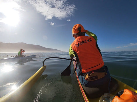
Five minutes later I came across a most wonderful breed of animals. 2 oc2s, and an oc1 carrying paddlers from the area. Friends from Pale Kai OCC had been very supportive of this journey. These folks took days off of work to greet and let me know I was in home waters now. They guided me home, and we all talked about the whale scene that they too had witnessed. My friend Si was on an OC2 with Tamara, which was one of my biggest hopes of the finish, that he would get some water time and get to come out and join me for the last leg...on the water!
We paddled in as a group. Saw a couple otters on the way, and finished at the beach. With some cold beers and warm hugs to celebrate the achievement. I took a long time to wash down my canoe and load it. I was not in a hurry to rush the post paddle experience. I clumsily peeled an avacado like it was an orange, and made a giant mess of myself as I shoved it in my face. I shoveled milk duds down my gusset and chased them with a hazy ipa. I was starving, cold, tired, and perhaps as happy as anyone could ever be.
Coastlines and adventures like this are special. They test us. They remind us. And they set us up for the future. Just got to remind myself every so often that 'we get what we seek - when we remember what we got.'
[ Photo credit and gratitude to Siam Mendoza, Jody Cox, Priscilla McKenney, Gary Cannon and Di Rose ]
Team Writer Clarke Graves - If there is water, he will paddle it (regardless of craft). Clarke is a surfer turned paddler who grew up in San Diego but has traveled every corner of California enjoying its beauty and appeal. He has had the privilege of racing SUP, OC6, OC2, OC1, Prone, Dragon Boat and Surf-ski.
One of Clarke's goals is to paddle as much shoreline in California as he can, with as many paddling friends who are willing to join him. If you have an idea for Clarke to write about or any questions, send it our way and we will pass it along!


Comments