


Too often we pass, walk or drive by something and don’t pay attention. Perhaps the first time we do. But life and our brain eventually says to us, “don’t worry about that thing, we know what it looks like already, save your attention and memory for something else.” And this is why life ends up going so darned fast as we get older.
Prelude...
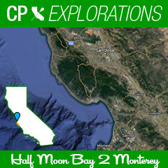
Lighthouses and different perspectives. So much of our coastline in California is famous and beautiful. Seen from roads up above, or from beaches as waves lap against our ankles. Perhaps we have been on a boat and seen something from the water, and say to ourselves, “hey that is really cool to see it from this perspective”. And we are right. Seeing something from a different perspective can be special. Both in empathy in our personal relationships with other people, and in how we see and appreciate the beauty all around us. My quest to paddle all of California has allowed me that new perspective. Bridges, lighthouses, cliffs and caves. Natural arches, roads, rocks and islands. This most recent trip took me from Half Moon Bay and the Pillar Point Harbor, south to Monterey Bay. It effectively closed a stretch of coastline for me that was previously un-paddled, and I can now say I have paddled everything from Mexico to Bolinas Bay. With patches beyond that to the north still haunting my dreams of completing it all, I can use this moment to feel a sense of accomplishment I have not yet felt. Everything from The Golden Gate Bridge south to my hometown of San Diego has passed my view at one time or another over the last several years. And the perspective has been soul changing.

This journey was supposed to have happened two years again, but the Santa Cruz fires and the horrible devastation to the wildlife and people during that summer caused me to re-route plans that year with my friend Scott Shoemaker. We instead paddled regions to the north. Having to adapt for conditions is nothing new. But I knew this stretch would eventually take place. And it did not disappoint. This time I had the wonderful company of Ernie Diaz. He and I had paddled the Catalina Island perimeter a few years back, and he has proven himself to be wonderful company and extremely competent on the water for these types of adventure. He perked up when I started this planning. He lived in the Santa Cruz area and in his words, “had driven that stretch dozens of times but wanted to see it from the water”. Perfect!

The first morning, we were staging our canoes at Pillar Point Harbor, after shuttle help from our thoughtful paddle friend Mike Irete who lives in the Santa Cruz area. Home of the famous wave Mavericks. As we were on the beach, we ask a nearby human to take a picture of us with my iPhone. He has a Vietnam War License plate frame, his wife sitting in the front seat. He obliges, takes several, and then says, “would you like me to get out my camera and take a proper picture?” Now, normally I would decline politely and say that the phone is “good enough”. Being focused on our tasks and gear and day ahead, a delay is not always something to invite. But for some reason, my mindset was different this morning. On behalf of Ernie and myself I said, “that would be awesome yes please!” He looked thrilled and told us we would be having our picture taken by an actual photographer who worked with Denzel Washington for his first film. Having stumbled on some magic, we then spent a few minutes working on the right shot, with the Half Moon Bay Radio towers in the background that are so iconic of the headlands and the legendary surf spot. His name was Dave Marcus, and he emailed me a shot that I will always treasure. He later send me some pictures of his career. He had an opportunity to share his story with someone. And I was sincerely interested in hearing it. Something only taking a pause and another perspective can lead to. After the impromptu photo-shoot, and us doing our best to be worthy of our image capturing new friend, we were motivated to hit the water and finish logistics for the morning.

Photo by the talented Dave Marcus.


Earlier that morning we stopped at a diner called Joe’s in Half Moon Bay. Loraine served us. The perfect diner waitress for a perfect greasy spoon meal. She called us “hon” as we sat down at the counter and never let the coffee get more than half empty. The toast was buttered well, the omelet evenly cheesed. Our stomachs would not be of want this morning. She told us about her fishing the local coast, and that we better be careful of sharks after hearing our path for the day. Including Bean Hollow Park where we had mapped as an emergency come in spot. Like characters from a Steinbeck story, Loraine and Dave were small roles in our week and travels, but left fantastic impressions on us that we would revisit throughout our time on the water.

The counter Joe's Cafe in Half Moon Bay. Order the Avacado, Swiss and Bacon omelette.
Day 1 Paddle (Pilar Point Harbor to Pigeon Point)
Our speeds were slow to start as we left the harbor. Immediately I felt that there must be a current opposing us for the amount of effort and speeds returned. Sure my canoe was extremely heavy with gear, but I quickly assessed that our times for the day might be affected if this kept up. I looked back one time at the headlands, the radar towers, and Maverick’s as I left the harbor and set my course south. Visibility was great this morning. A high coverage of clouds was present to be sure, but on the water we could see 5-8 miles. Much different than last time I launched from here and headed north with Scott where we had to use the fog horns to find the entrance of the harbor. "Seeing" this morning gave a positive spin for sure. Not seeing always adds a different level of trepidation. But that moment was not now. Grey and calm, we were headed towards points and cliffs off in the distance. The wind was starting mild this morning, 4-6mph. It would pick up later to 12-15 for the last hour or so based on our times, and be in a favorable direction.

We paddled south for the morning. Taking pre-planned breaks every hour to fuel up, lube up and check our progress. We paddled by a giant Ritz Hotel that looked like a castle. They had effectively blocked this portion of the coastline access for only their guests with much uproar from residents and Surfrider Foundation. But our view was unobstructed so we made a point to take it in for the rest of civilization and the paupers among us who can’t afford to stay at the castle. We had some curious dolphins and seals checking us out. At one point, Ernie and I both spotted something coming right for us that was neither a dolphin or a seal. I didn’t know if I should veer off course or hold my line. Could this be a great white shark that the area (part of the Red Triangle is so famous for)? I initially held my line, but it still came right towards me and at the last second I ruddered right to avoid contact. The meandering creature was a Sunfish (Mola mola). It did its best to smile at me as it went by and I was grateful that I was not wearing a heart rate monitor for this paddle as there would be an embarrassingly high zone 5 spike. Ernie and I both had a chuckle and we continued south.
Around mile 18 we saw up in the distance our beacon and finish line. The Pigeon Point Lighthouse. This is the 2nd tallest lighthouse in California at 115 feet tall, and as intended, was visible from far-away distances as it has been since it was built in 1872. Having now seen it on our current day paddle, we set our course for this next landmark, knowing that here would be a friendly beach and cove to land at. It would also be our home for the night as it functions as a hostel and we had ourselves a booked dorm style bed to look forward to steps from the landing spot. Absolutely perfect.
With about 5 miles to go Earnie and I both heard the sound of air blowing loudly. The blowhole of a whale! We immediately started scanning the ocean in the direction we heard it. Hoping to be close, (but not too close!), to an animal I have always had a connection to. When we were about to give up I suddenly saw a dark grey black animal quickly surface and saw its small fin. Not a grey whale I am used to seeing this one was different. I later looked up and confirmed, it was a Humpback whale!

The last two miles were frisky and fun as the wind had turned on. Zigging and zagging now, where as before we were trudging along with minimal help and staring at seemingly unmoving (albeit beautiful) landmarks, our speeds and smiles grew. We had made a point the day before to study our entry into the cove. There were many rocks and submerged reefs with breaking waves before turning into the lee of the wind and swell and into the protected cove. We made a pact not to cut too close as we finished and get caught off guard by a rogue wave. Not worth a shortcut to get washed onto barnacle-covered canoe-breaking journey-ending hazards. This afternoon the tide was a little lower and we saw a few more that were exposed and tempting us to come close too. But we stayed true to our pact, swung wide on our left turn into the cove, and felt the reprieve from the wind which had apparently been building to a decent level. The smell of seaweed and the ocean in the cove was lovely. Tourists took pictures of us from the rocks above. We landed at the beach. 26 miles of blissful paddling and contemplation. Minimal buildings on the coast. Just coves, beaches, cliffs and that one castle. Day 1 was a success. And only a sunfish encounter to get the heart rate at an elevated level of fear.
Day 2 Pigeon Point to Santa Cruz Harbor
While the previous day was a lesson in calm and trudgery along the beautiful coast, today was anticipated to be a day of adrenaline. Both from the forecasted winds of 15-20 mph throughout the day, but also from our rounding of Ano Nuevo. Know for an elephant seal rookery, tons of fleshy sea life, and a popular spot within the Red Triangle. The Red Triangle is a “triangle-shaped region off the coast of northern California, extending from Bodega Bay, north of San Francisco, out slightly beyond the Farallon Islands, and down to the Big Sur region, south of Monterey. The area has a very large population of marine mammals, such as elephant seals, harbor seals, sea otters and sea lions, which are favored prey of great white sharks.[1] Around thirty-eight percent of recorded great white shark attacks on humans in the United States have occurred within the Red Triangle—eleven percent of the worldwide total” (Wikipedia).

Ano Nuevo Lighthouse Island - Image gratitude to https://www.lighthousefriends.com/light.asp?ID=79.
All that said, to summarize. Ask any local about Ano Nuevo and they will answer in a single word. “Sharky”.
So as you can imagine we did not intend to spend much time at this famous spot, with a cool island where animals rook, and that juts out along the coast. This would be 6 miles south of our start this day. Instead we planned to go suuuuper wide of it, and then line up with the wind for the remaining 22 miles or so, and leave all that drama behind us.
The launch was spectacular from Whalers Cove. We had Ernie’s friend Rich who helped us car shuttle that morning wave us off from the beach. He had the honor of explaining to a tourist family on the beach what our craft were and where we were going. The usual guffaw of shock ensued and he was able to field the anticipated questions for us. “How far is that?” “How long will they be on the water?” “What do they carry if something goes wrong?”

The winds were already showing their potential for the day and we kept Ano to our left at about 11 o’clock on a watch face. The anticipation of the location kept our dialog to a knowing minimum. Neither of us spoke out loud about The Man in the Grey Suit. The Landlord. Mr. Fin. As surfers and watermen, we both understand superstition and protocol about these things. Speak of it, and it will be real. Act like its not a thing and everything will be just fine. So we followed this very scientific approach all the way to the Point. When we arrived we kept paddling even though it was at our normal 1 hour stopping point. We saw a red navigation buoy way ahead and agreed that would be our location to rest. The barking of seals on land reminded us of the buffet nearby. I was glad when it drifted behind me. Replaced by the wailing and groaning of the red buoy which was equipped with a wind whistle device that makes an eerie noise that accompanied a bell sound. Haunting as the mood was already, it provided a great soundtrack.
As we rounded the red buoy (just realized the color was appropriate), the sounds of seals and wailing buoys was replaced by a much more intense sound. One that was building in decibels, and consistent in its direction of origin. The sound of the wind!
The ensuing 2 dozen or so miles were going to be a blast. While remote in terms of development and access, the area is famous for great downwinders. The second half today would actually be a very famous run where a race is help called the Davenport Downwinder. I had paddle the race once, but it was sadly the year it was glaringly called the Davenport Upwinder as the conditions had switched and it was a suffer-fest for all entrants who proceeded to run the course. The race is primarily a prone race, and those salty paddlers are never one to back down from conditions or challenges. They each embraced the day as character building and mocked anyone who flinched at “a little breeze in the face”. I was proud to participate that year, despite the hard work needed. Today however would be a much more typical Davenport day. 15-20mph with gusts in the 24-26 range. Enough to make for entertainment the entire stretch. And after the benign conditions most of the previous day, Ernie and I were stoked for the texture and alignment with our heading.
All that said, whenever we weren’t on a wave this day, the current was once again bucking against us. So this made for a peaky speed day. Fast fasts. Slow slows. And we were both struggling to make connections on the bumps. That said, it was still very fun and entertaining. The ten miles from Ano Nuevo to Davenport were spent regrouping each make to make sure any distance between us was minimal. Losing a wingman is easy when there is conditions as one person can stop while the other gets a quarter mile ahead with just a few lucky connections. And since this stretch was pretty foreign to paddling still and rough to come in to land if needed, we were certain to make sure there other paddler was always upright and pointed the right way. When we finally got to Davenport, our downwind was halfway over and the faces told the story of fun and fast rides. But agreement that there was challenges to maximize the wind on a day we both thought would be sleigh-rides. First world paddle problems to be sure. 😊
After passing Davenport we set our eyes on a point at 12 o’clock which would be rounded and immediately transport us from no-man’s land to civilization again. With the other side having buildings a plenty replacing the rolling hillsides and agriculture and bluffs. We knew our respite from traffic and sounds would end soon, so we made a point to enjoy the sanctuary a little bit longer and add some zigs to our zags. But, as the wind would have it, we quickly got to the point, and sure enough, before us was the town of Santa Cruz. Natural Bridges Beach. Famous lighthouse on the point. Steamer Lane, the world famous surf spot. Lots of seaweed to dodge. The wind died down, and the bumps mellowed out in size but still were fun to catch for another mile or so. Then we began the final trudge home across the little bay to Santa Cruz Harbor. To a third small lighthouse on the harbor entrance jetty. And then a hot last mile of flat water in the harbor to our dock. Our car. And completion of a remote stretch of coastline that had been filled with wind and anxiety of something we never saw. But understood was lurking under each bump.
Day 3 – Santa Cruz to Monterey Bay – MBX
The Abyss. The first day was good visibility. The second day had good visibility as well. This third day? By Monterey Bay standards would be as expected. Minimal if any visibility. Actually this is not entirely true. We could see a good 1 mile when we launched and looked behind us to see the land we departed. But our course would have us crossing the Monterey Bay, instead of doing a perimeter. And we would be at least 12 miles off land in any direction when we got to the midpoint of the bay. So as you can imagine one mile of visibility is pretty un-celebratory in such circumstances. But we knew ahead of time this is par for the course. We would be relying on our multiple gps and a compass with a heading of 270 degrees. Too far south and we get out into the real ocean. Too far east and we add miles off course and suffer side winds at the end. If we hold true we would be running parallel to the swell, which is frustrating to not get to harness, but the winds would not surface until noon. And we launched a little after 8. Our shuttle team of Rich and his wife Karen were amazing again today. And they drove a car of ours to the finish so we could get on the water sooner. Why sooner? Because of those unhelpful afternoon winds the reports forecasted. We wanted to trade an extra hour or so of limited visibility for more tame conditions. Tough conditions after 3 days and 80 miles is generally tougher than when fresh. And because our luck had been good so far, we didn’t want to tempt fate.

Santa Cruz f- inal preparations and launch.
For whatever reason, I had a feeling this day would be a little more soulful. When you don’t have things to look at and keep your bearings with, you rely more on senses. Knowing this would be less visual and more tactile, I looked forward to those moments where I couldn’t see anything but the water in front of me. It can be disconcerting for sure. But also peaceful. And grounding. Which is ironic since we are not on the ground but the water. Ernie and I seemed to both be after this reward. Not because we were weary of each other. Which after spending the last 4 days joined at the hip in car rides, paddles and hostels, would be understandable. But no we were surprisingly still as enthusiastic to hang out with each other and congenial. No this was more of a ‘what the moment calls for’ kind of situation. So we quiet. Contemplative. And focused on the abyss surrounding us. The quiet of no roads. Just birds and our paddle hitting the water.
At one point I called attention to ahead of us. I had just seen a shark jump out of the water 20 yards in front of us. It was a small guy, a thresher shark with long swept tail. I called out “got some activity in front of us a little ways”. Vague code for “be alert” something maybe not friendly. The shark jumped again, this time for us both to see. “Ernie replied, “aww he’s a leetle guy”. And we both took comfort in the other person’s excitement for the sighting instead of fear. Later on we had a curious seal follow us for a quarter mile. Another 30 minutes Ernie spooked a sea lion who didn’t expect to have a 20‘ canoe pull alongside him. Around the halfway mark of 13 miles, after many times correcting our course when the GPS and compass made us realize we were constantly at risk of veering off course, we took a long break.
The Monterey Bay depths are as interesting as the sea-life. Bathymetry, a word I learned from Rich, means the study or information of the ocean floor and terrain. Underwater mountains and canyons can create dynamic environment of citizens and energy. And Monterey Bay has an underwater grand canyon of awesomeness. Monterey Canyon in the middle of the bay goes almost 250 miles out to sea. At its deepest point, it plunges to 2.5 miles deep. There is a magnitude of literal depth here that added to the spiritual and cerebral depth. It was here that we took pause to really soak in the disconnectedness we were subjected to. Minimum 2.5 hours of paddling to land in any direction. More space below us than I have previously hovered over on water. Skies in every direction looking the same. Grey. Misty. Cool. Swells lulling underneath us from right to left. And only the sound of the water lapping against our hulls to make us realize we weren’t in some sort of vacuum. It was other-worldly. Truly an abyss.
After lengthily taking in the moment, refueling, and setting our bearings we began what would best be described as the final downhill portion of our week. We were over halfway done with the last day. The wind was still mild due to our early start. And while couldn’t see it. Land in front of use was now closer than the land behind us.
We saw a fishing boat or two as we crossed. One was a father son who curiously pulled near us to ear-shot. I asked if they “could point us to the In-n-Out”. The each seemed to be coming from the direction we were headed. Our course matching their take off spots gave me extra confidence we were heading the right way. After we saw the boats it got quiet again. Ernie and I again disappeared into our own conversations and experiences as the miles piled up. I made it a point here to check in with those who I can really only talk to when I am alone far away on the water. My Father, my Uncle Pierce, Pa, Uncle Dave, my Grandmother. My friends Moon and Aimee. My Aunt Kitty. My mother-in-law Kay. (Darn it if that list isn't longer each time:). I spoke to each one and shared with them what was going on in my life since I last spoke to them in similar settings. Talking to the deceased is hard on land. Too many distractions to pull you away from them. But here, our dialog is pure and uninterrupted. Most importantly, I share my gratitude for what each of them gave me. The life lessons I gained and how their influence has been felt and appreciated. It was remarkable how flowing the conversations went. After getting caught up with my departed dear ones, I sang a few Hawaiian songs out loud. Ernie and I had come back near each other again around here, and my singing didn’t offend him too much I guess. Shortly after this, we started smoke stacks to the left of us. Moss Landing materialized way way off in the distance. Our emergency put in spot if needed. We did not. That said, had we drifted off course to the left too much to be seeing land in that direction? We would not be sure until we saw the final charts of our course. But the modest concern did some up for us. Another half-hour however, one of us pointed out that we saw land in front of us. The other confirmed after some straining of the eyes that they saw it too. Our finish line was in sight! Sort of.
With anything distance related. It is often further than it looks. And while the land being spotted gave us a connection we had been missing, it would still be 2 hours before we would get back. So we slowly trudged on. The conditions built as predicted and wanted to push us left, but it was more quartering now, and hence, more helpful. We took another break at mile 18ish. Ernie heard a whale blow. We set our sights in the direction and played the visual whack-a-mole game that is whale watching. Which should be called whale-looking-for if you ask me. But we were rewarded! 4-5 times we saw a humpback whale surface. Its dark skin and small triangular hump cresting to the east of us towards land. Ernie called out “over there” and I saw it lift its tail in the water and dive down. Whales have always been special to me. Connections with them has come in profound ways. Here was another time, I was rewarded with seeing a whales on a journey. I pocketed this experience in my mind. Reminding myself how lucky I was.

Humpback Whale image courtesy of https://www.fisheries.noaa.gov/species/humpback-whale.
As we made our way to Monterey, I heard the radio call on the vhf handheld I kept on board and leave on for comms with Ernie if we get separated or emergencies with rescue services. “Rich to Ernie and Clarke. Rich to Ernie and Clarke paddling outrigger canoes. Santa Cruz to Monterey do you copy?” It was repeated and I picked up. Rich was at a high spot in Monterey and despite the fog thought he might get radio contact with us. Success. “This is Clarke and Ernie, we copy. We are about 2 miles off lovers point on Monterey Peninsula. 3 miles from Del Monte Beach. Over.”
After the excitement of both parties that contact was made subsided, Ernie and I found some renewed jubilance to our stroke. We had people waiting on land to greet us. Something very special in that. The sights in front of us and alongside us were growing more and more familiar. Pebble Beach. Lover’s Point. Monterey Bay Aquarium. A Fishing boat came by and dropped a huge wake which I slopped up like a greedy dog drinking water. The wind was in our sails. We were getting very close.
Not to let the dolphins, whales and sharks get all the glory, Monterey resident Sea Otter capped off the final stretch. We circled around to give them the proper waves as they floated on their backs and nodded our way. A perfect little finish to our sea life cruise. We had the land we would beach out in sight. Side by side we headed towards our welcoming crew, flying our amas as much as 80 miles of fatigue would allow, and caught a tiny roller into shore and touched land. We were safe on land!

Amas up finish as we come into Del Monte Beach in Monterey Bay!
Epilogue
The greatest thing about these journeys is the outpouring of support and enthusiasm where we have explored. This trip was no exception. And was finished with a most special greeting when we finished our collecting and loading of gear and changing into civilian clothes once again. From across the parking lot, I saw Jim Dimke the coach of Hi’ilani of Ke Kai, the local Monterey Bay Outrigger club. I have paddled with these folks before and they are about as true to the aloha spirit as any club could be. Soulful in respecting the sport and Hawaiian culture. They truly understand how special our sport is and I am so lucky to call them friends. Jim called out a big “congratulations on your trip!” to me as I approached. Apparently he was aware of the endeavor we had finished. He was excited to hear about it and so proud. He then invited us to attend their pre-paddle pule (prayer) before launching at practice where they wanted to share our accomplishment with the entire club. I was blown away at this invite. And truly felt it was as special a gesture as anyone could be given.
So about 15 minutes later, after canoes were portaged to their beach for paddling, and joking that Ernie and I should join them for their practice (admittedly I half-contemplated the idea), we gather in a circle, clasping hands. And exchanged mana, stories, and aloha. And my journey, for the day, for the week, and for the last several years, felt pono (right).
While I still have much of Northern California to tackle, I can now say I have paddled everything from Mexico to beyond San Francisco. And see it from a perspective that is rare, and beautiful. Thank you to my support crews. On each journey, for every mile. From every part of the state.
See you on the next adventure!
Clarke
Team Writer Clarke Graves - If there is water, he will paddle it (regardless of craft). Clarke is a surfer turned paddler who grew up in San Diego but has traveled every corner of California enjoying its beauty and appeal. He has had the privilege of racing SUP, OC6, OC2, OC1, Prone, Dragon-boat and surf-ski.
One of Clarke's goals is to paddle as much shoreline in California as he can, with as many paddling friends who are willing to join him. If you have an idea for Clarke to write about or any questions, send it our way and we will pass it along!


Mark - October 01, 2024
Great post, Clarkester!
Deborah Hudson - July 31, 2023
Such beautiful writing and a very special experience. I swim with Ernie in our Catalina Swim Club and he is indeed a special person and a good companion for adventures